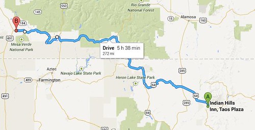
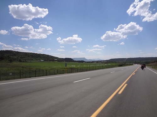
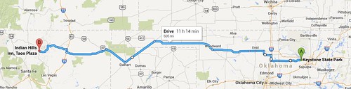
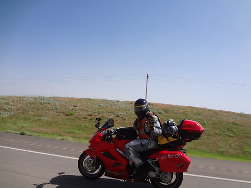
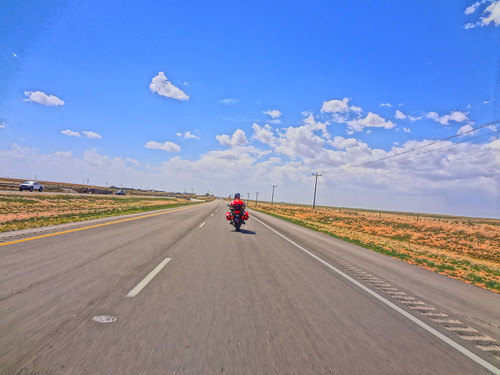
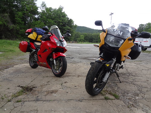
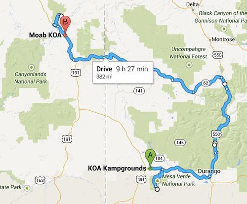
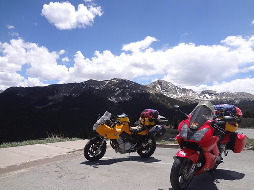
Daily mileage: 385mi
Trip mileage: 2,760mi
State count: 10
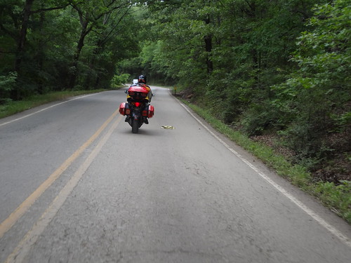
With a 9:30 tour booked, we knew we needed to roll out of
the KOA 8:00am to get all the way back into the park to where our tour
was. It was a nice, cool morning,
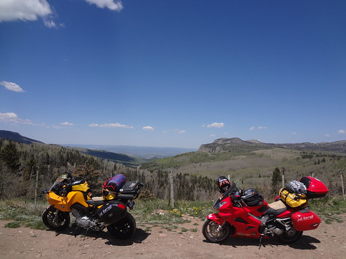
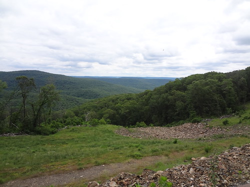
and absolutely beautiful through the park. Being up on the mesa was incredible, with views in every
direction. And really good
pavement and nice turns. We
stopped at a few overlooks to walk around and take some pictures since we’d
built in extra time, then headed to Balcony House. Each tour can have up to 50 people, but with it being in the
early morning, there was only us and one other couple! Our park ranger was able to give us
lots of “extras” as far as details and bits of information to share, that he
couldn’t do when he had a full group.
It was really incredible to think that people built this nearly a
thousand years ago. It was a very
incredible story, and so amazing to transform back all those years.
View from the Mesa:
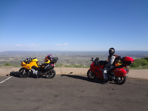
View from the Mesa:
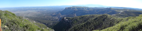
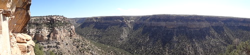
Panorama from the Mesa:
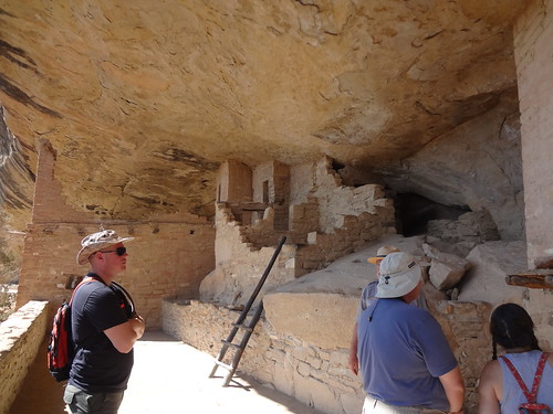
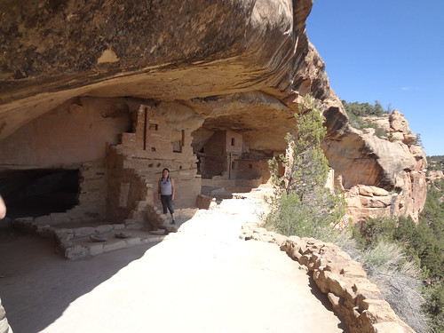
Balcony House:
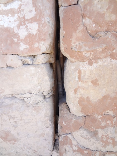
Prayer sticks found in Balcony House - this was a very sacred place for the people who lived here:
What a view from their balcony!
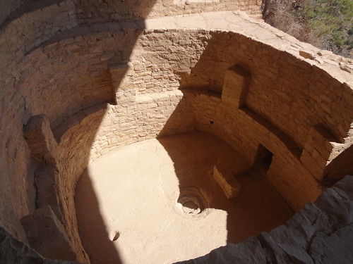
Balcony House Kiva (one of two):
The remains of Balcony House:
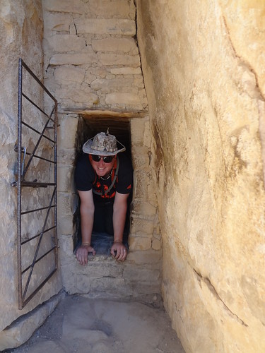
Larkin coming out through the entrance, very easy to defend:
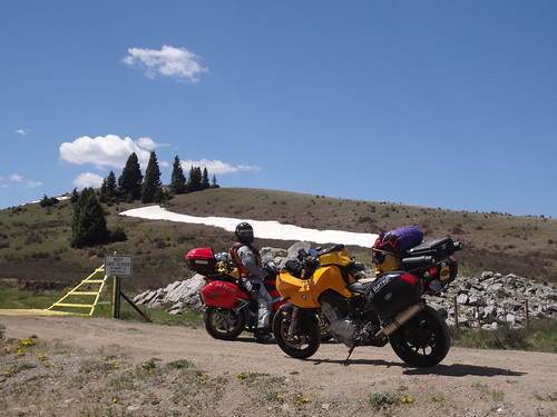
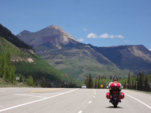
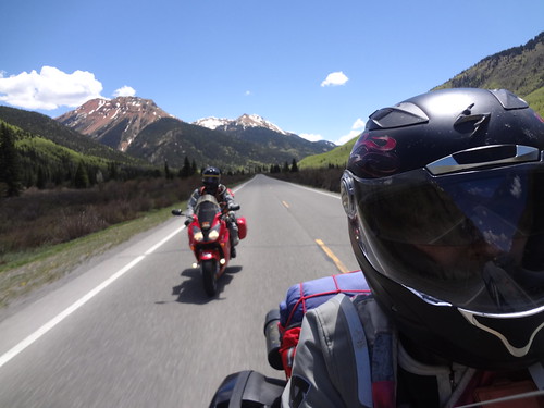
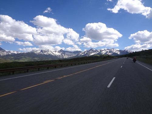
After chatting with a few bikes in the parking lot after finishing our tour, we headed out. Next checkpoint was the Million Dollar Highway, highway 550 from Silverton to Ouray. Such incredible views!! It was straight, then curvy, so you could enjoy the scenery during the straight part, then pay attention to the road and enjoy the curves also. Climb and fall, climb and fall, beautiful sites in every direction!! We were literally “Oh, look at that!” for 50 miles. Larkin thinks we may just have ruined the rest of our trip with all the awesome sites. On the backside we ran into a father and son who just come down off a jeep trail on their dirt bikes. Yeah, next year… :D
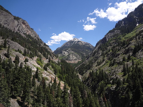
Large, majestic mountains:
What a view from their balcony!
Balcony House Kiva (one of two):
The remains of Balcony House:
Larkin coming out through the entrance, very easy to defend:
After chatting with a few bikes in the parking lot after finishing our tour, we headed out. Next checkpoint was the Million Dollar Highway, highway 550 from Silverton to Ouray. Such incredible views!! It was straight, then curvy, so you could enjoy the scenery during the straight part, then pay attention to the road and enjoy the curves also. Climb and fall, climb and fall, beautiful sites in every direction!! We were literally “Oh, look at that!” for 50 miles. Larkin thinks we may just have ruined the rest of our trip with all the awesome sites. On the backside we ran into a father and son who just come down off a jeep trail on their dirt bikes. Yeah, next year… :D
Large, majestic mountains:
Beautiful!
Just stunning:
Riding the Million Dollar Highway:
Breathtaking:
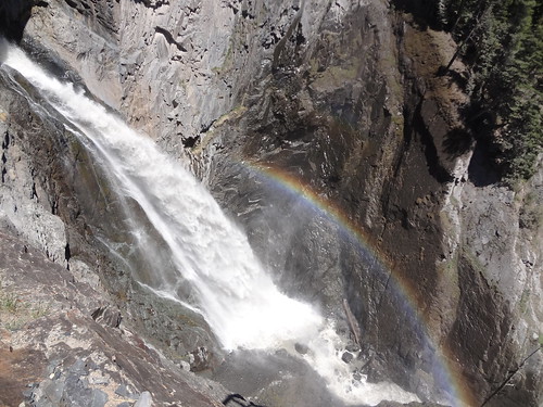
Waterfall just outside Ouray:
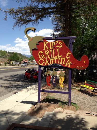
We had lunch in Ouray, in a cute little brewery (also
suggested by the Multistrada guy).
The brewery burger was fantastic!
Unfortunately, the town is on a hill, so even though Martinique parked
her bike to hopefully not get stuck, Larkin still had to help her get it
righted and off the kickstand, lol.
What a lovely place to have lunch!
Per the suggestion of a couple GS/V-Strom guys we ran into when we got into Ouray, we opted for 62 to 145 in order to get to Moab. Luckily, it was the route the GPS wanted us to go anyways. And it did not disappoint. Again, incredible views! Colorado is so amazing, how could anyone NOT want to live here! Everywhere we go, the views are to die for.
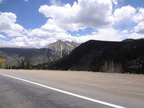
Continuing the beautiful views outside of Ouray, these mountains had the most snow that we'd seen so far!
We had booked a KOA cabin for Moab (again, because they
don’t have trees you can tie to) during lunch. Got settled, and asked where the best place to watch the
sunset would be. They suggested
Arches, and that everyone goes to Delicate Arch, but it’s a 1.5 mile hike up
and back. We were tired, and
didn’t feel like hiking in the dark, but they said we may be able to see some
cool sights at Windows. So we
headed for the park for the sunset.
Arches is so unlike anything else.
The way the weather erodes the rock into beautiful formations. We found a nice place on an arch to
watch the sun dip below the horizon.
It was truly magical to watch the sun on the red, red rock.
Windows arch:
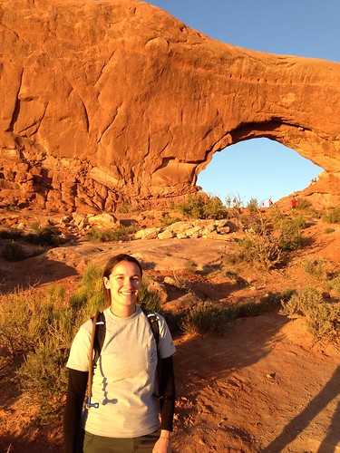
Windows arch:
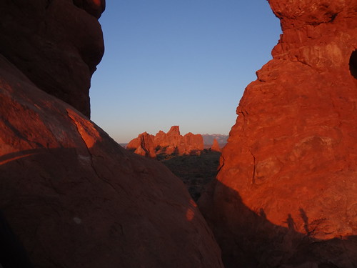
Turret arch:
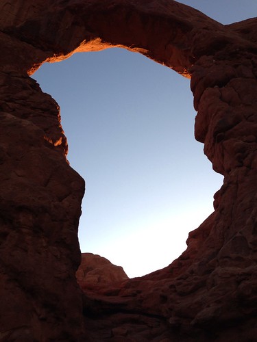
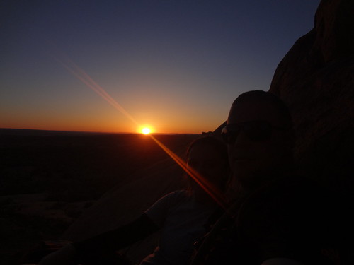
The sun setting through Turret Arch:
Watching the sun set on Turret Arch, magical:
As we drove back through Moab, it was a pretty hopping town. We were both too tired to want to hang out though. As we got back to our cabin, we were dreading the thought of hoofing it to Zion the next day. It seemed like we’d been going, going, going, all the time. We were in desperate need of a rest day. So we decided we were going to spend an extra day in Moab. Wake up late, ride around some of the beautiful roads (Canyonlands was not too far away, but originally we weren’t going to have time to explore it), chill in the pool, take it easy, see Delicate Arch at sunset, and enjoy the nightlife. Then, after feeling refreshed, we’d head out to Bryce Canyon and Zion National Park. This means we’ll probably cut out 191 in AZ (and the Petrified Forest), but it’s pretty far out of the way. Zion will put us on the West side of the state, and both those things are on the East side. We saw a quote in the Visitor’s Center at Mesa Verde “If you try to see everything, you’ll actually see nothing”. Very true. We’ve tried to cram a lot of things in the trip, and it’s hard to fit it all and really enjoy it. Time to relax, and enjoy it.
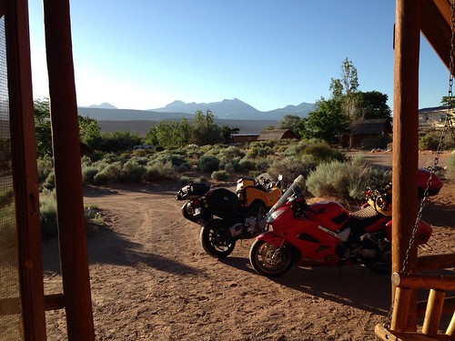
Beautiful view from our cabin, time to kick back and relax!
Watching the sun set on Turret Arch, magical:
As we drove back through Moab, it was a pretty hopping town. We were both too tired to want to hang out though. As we got back to our cabin, we were dreading the thought of hoofing it to Zion the next day. It seemed like we’d been going, going, going, all the time. We were in desperate need of a rest day. So we decided we were going to spend an extra day in Moab. Wake up late, ride around some of the beautiful roads (Canyonlands was not too far away, but originally we weren’t going to have time to explore it), chill in the pool, take it easy, see Delicate Arch at sunset, and enjoy the nightlife. Then, after feeling refreshed, we’d head out to Bryce Canyon and Zion National Park. This means we’ll probably cut out 191 in AZ (and the Petrified Forest), but it’s pretty far out of the way. Zion will put us on the West side of the state, and both those things are on the East side. We saw a quote in the Visitor’s Center at Mesa Verde “If you try to see everything, you’ll actually see nothing”. Very true. We’ve tried to cram a lot of things in the trip, and it’s hard to fit it all and really enjoy it. Time to relax, and enjoy it.
Beautiful view from our cabin, time to kick back and relax!